"Thigpen's Trace"
THIGPEN TRACE
“Thigpen Trace, the oldest military road in Georgia, was cut by James Thigpen
to transport military supplies of Col. James Moore, former Carolina governor.
It followed a well beaten trail of the Indians from the mountains to the sea in use
before the era of the white man. Coming from South Carolina above the Broad River,
along the Chattahoochee water divide to the Gulf of Mexico, it avoided all swamps
and great rivers. The English claimed the territory as Carolina while the Spanish
claimed it as Florida. Col. Moore led the English in an attack down Thigpen Trail and
“made Carolina as safe as the conquest of the Spanish and Appalachee (Indians)
can make it.”
GHM 159-3 GEORGIA HISTORICAL COMMISSION 1956
Perhaps the most important road in North Carolina history, Thigpen's
Trace is a road most have never heard about. It has a highway marker
in Georgia but none in South Carolina, Virginia, and North Carolina. It
dates back to 1704 and profoundly influenced settlement patterns and
demographics in the backcountry of the Carolinas. As a war road, it may
have brought remarkable peace to the backcountry, more on that in a bit.
In 1702 a World War broke out between Spain and France and England
for various reasons but not least because each was interfering with the
other's pillaging of North America. It was called Queen Anne’s War.
Immediately upon learning of the hostilities Carolina, which
neighbored Spanish and French claims and suffered raids by Spain’s
allied Native Americans, went on a war footing under the former Carolina
Governor, James Moore. Captain (later Major) James Thigpen of the
Chowan District on the South side of Virginia was given a contract to
construct a military road from the Chesapeake to the Gulf of Mexico.
Roughly 450 miles long, this road was to transport military supplies, that is,
it was a wagon road.
[Based on the work of John Lawson]
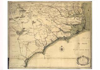
On this 1733 map several roads appear in the Quaker settlements on the
north shore of Albemarle Sound, but the only other roads on the map are
a road from the Albemarle to Charleston and a road labelled as "Indian
Trading Road from the Cataubos and Charokee Indians to Virginia." This,
for the following reasons, is likely Thigpen's Trace. The evidence supporting
this theory is cartographic and historical.
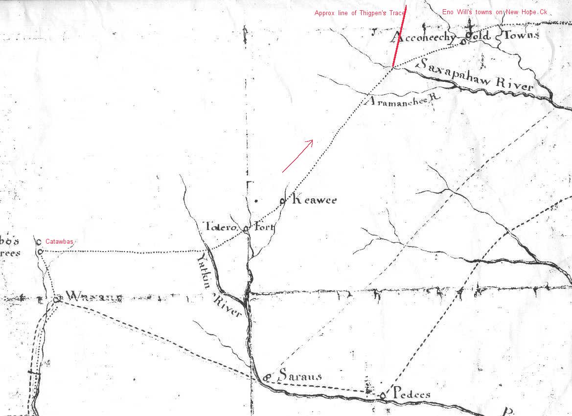
Cartographically we have the Moseley map which appears to show a wagon
road arcing across North Carolina's piedmont. Much of this map relied on
John Lawson’s survey work between 1701 and 1710. Moseley assumed
Lawson’s position as the Colony’s Surveyor General and inherited his
surveys after Lawson’s death (1711). It is likely that most of the work that
went into this map was Lawson’s. Lawson traveled through the Carolina
backcountry in 1701, took notes that inform most of what we understand
about backcountry Carolina Native Americans just after first contact with the
English.*
Before the 18th century, map symbology was chaotic but by the beginning of
the 18th century European geographers knew there needed to be some
standardization. One of the earliest such standards was for identifying wagon
roads versus horse, trails, or porter trails. By the third decade of the 18th
century the convention had settled on two parallel lines, the same mark
wagons make on the ground. Horse trails were marked with dashed single
lines, cart paths by small "os" and footpaths by dotted lines. The "Trading
Road....." shown on Moseley's map consists of two parallel lines. As there is
no other road in the backcountry except Thigpen’s Trace, it is likely that John
Lawson mapped the old road sometime after 1704.
There may be another map that shows a portion of Thigpen’s Trace. The
Barnwell-Hammerton Map (ca 1715) purports to show three recruiting trips
made by Jack Barnwell during the Tuscarora War during which he recruited
Native American levies with which to fight the Tuscarora. After it reaches the
Catawba on the Catawba River it seems to follow the same line as that
shown on the Moseley Map. At the Haw River, though, It abruptly turned
down country to follow the Neuse River to the Tuscarora towns below the
Fall Zone. Lawson may have had a version of his map during his 1701
travels through the backcountry.**
Historically, we have one documentary source. We have yet to find Thigpen's
contract with England, Carolina, or Governor Moore to build the road. But we do
have some otherwise difficult to explain facts. To wit: there is strong evidence that
the backcountry was heavily populated before any government arrived and grants
became common.One study of British property confiscation receipts issued in 1781
for property taken by British officers, found that 60% of the people named in the
receipts appeared in no other North Carolina records; not deeds, nor road orders,
nor jurys, nor militia. To appear in any of those records a person needed to own
land. So the findings suggest a large population of unlanded people with property
worth confiscation. Albemarle Quakers wanted nothing to do with Anglican
government and would have avoided paying tithes to their Anglican vestry at
practically any cost. Finally, when the people around Cane Creek in Alamance
County wanted to create a meeting in the early 1750s they sent two women down
to a Perquimans County Quaker Meeting to gain permission.***
Roads, whether Native or European, are commercial infrastructure, they facilitate
trade. They always lead to valuable assets, unless blocked people will use them.
The asset in question was unused farmland and its allure undoubtedly drew settlers
down from Virginia, Maryland and points north. Among the earliest farmers to
venture down the road it is likely there were Quakers from the Albemarle
settlements.****
Anglicans took over government in the Albemarle with the failure of Cary's Rebellion,
a confusing and desultory affair that is difficult to characterize which lasted from
1705-1711. Until 1705 the Albemarle settlements were under the control, sometimes
legally and sometimes not, of religious dissenters who around 1650 escaped from
Anglican and Catholic abuses in Virginia and Maryland respectively to sheltering
below the Dismal Swamp. Many of the dissenters were former Cromwellian soldiers,
and were armed and dangerous. So Virginia opted to let them be.
The dissenters, who it seems were proto-Quakers, lived peacefully there for fifty
years or more. They entered into and honored a treaty with local Native Americans,
perhaps brokered by Nathaniel Batts, a trader on the sounds. The treaty gave them
the right to occupy the land on the north shore of Albemarle Sound. There was but
one limitation placed on them, they agreed to not settle west of the Chowan River,
and so long as possible they honored that treaty.
With Batt's cooperation they also established relations with the privateers and
pirates who frequented the sounds and traded booty for crops. This effectively gave
the dissenters access to European goods and a navy which increased their security.
Alas, eventually friendship with Blackbeard ended Quaker control in the Albemarle
as it brought into the sounds enough military force to capture and execute
Blackbeard and replace the ruling Quakers with Anglicans.
In 1672 George Fox, the founder of The Friends Society visited this dissenter
settlement and in his journal he noted that the Albemarle settlements set a good
example of how Native and English could live side by side in peace. In fact there
was considerable mixing of blood and cultures. This was all brought to a stop by
Anglican determination to oust dissenter government. One earmark of Anglican
influenced decisions was that, starting around 1705, settlers pushed over the
Chowan River to take up claims to Tuscarora land. This all culminated with the
Tuscarora 1711 execution of North Carolina's Surveyor General, the man
responsible for selling North Carolina land to settlers. And that event led to the
Tuscarora War which decimated Native Peoples below the fall zone.*****
Desperate for liberty, many of the Albemarle Quakers moved west to escape
Anglican oppression. The only wagon road into the backcountry was Thigpen's
Trace, so it is likely that was the route along which they moved their farms. Once
in the Piedmont the Quakers, according to the lore of the Occaneechi-Saponi
peoples, became the protectors and patrons to surviving Native peoples who were
until then regularly raided by slavers. Thus they ensured peace would reign in the
backcountry, thanks to Thigpen’s Trace.
Later, around 1750 Quaker settlers from Pennsylvania took up land in the Piedmont
too, and variations in their religious tenets led to friction between the two Quaker
groups. That friction may have played a role in the War of the Regulation.
too, and variations in their religious tenets led to friction between the two Quaker
groups. That friction may have played a role in the War of the Regulation.
Vestiges of our Albemarle Quakers live on among us. For example, Albemarle
Quakers had women meeting leaders, something banned by both the London and
Philadelphia Meetings. And to this day North Carolina has the highest per capita
incidents of women lead meetings in the US. It may not be too great a leap of
imagination to claim that the early and persistent Albemarle Quaker presence is
the reason North Carolina proudly became ‘A vale of humility between two
mountains of conceit.’
***********************************Notes**************************
* John Lawson, A New Voyage to Carolina, London, 1710. There are several editions of this book
and one reprint of the origins (Naples, FA, Readex, 1966).
and one reprint of the origins (Naples, FA, Readex, 1966).
** A copy of the Barnwell-Hammerton map resides in and may be seen at the North Carolina State
Archives. Barnwell and the Moore cousins were traders working out of the Turkey Creek area
outside Charleston. It was this "Turkey Creek faction" that more or less sponsored Lawson's trip.
"“Fall Zone” is defined as the terrain between where a river falls off of the piedmont and
where it begins to cross the coastal plain. The bottom of the fall zone is, generally, the head of
muscle powered navigation.
*** L.E. Babits, "Military Records and Historical Archaeology" in Documentary Archaeology in
the New World, Mary Beaudry , 1988/1993.
the New World, Mary Beaudry , 1988/1993.
**** As of 1701, Lawson estimated that not one in six Native Americans survived from just a few
decades ago. Most were probably slaved into the Carribean where every three were worth two
Africans, and the rest succumbed to disease and absorption into the new order.
decades ago. Most were probably slaved into the Carribean where every three were worth two
Africans, and the rest succumbed to disease and absorption into the new order.
***** The difference between a pirate and a privateer is that privateers were governed by “letters
of marque,” documents that authorized them to capture enemy vessels in a time of war. Obviously,
peace-time was of no use to privateers and many continued taking prizes when their war ended.
Blackbeard, John Teach, was a privateer turned pirate. He was friends with Carolina’s governor but
he made a tremendous blunder during Queen Anne’s War, he blockaded Charleston harbor and
demanded a large ransom to lift the blockade. The British Navy in the Caribbean had cooperated
with Governor Moore in his attack on Spanish St. Augustine and prevented the Spanish fleet from
coming to St. Augustine’s aid. After that war the fleet was made available to the governors of Virginia
and Carolina and they settled two scores at once using this naval force. Virginia militia and Royal
Marines descended on the Albemarle while the British fleet trapped Blackbeard in the sounds, fought
him, captured him, hung him, and beheaded him. They were only slightly more generous with the
Quakers of the Albemarle.

Comments