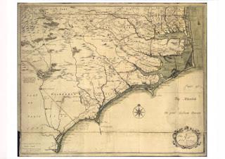
Thursday, March 15, 2012

Settlement north of Albemarle Sound, 1650-1710: the founding of Albemarle

When North Carolina Became a Refuge

Albemarle Sound in the northeast corner of modern North Carolina was once, pretty much, the southern reach of  Virginia.  Rivers produced this result, specifically the Roanoke and Chowan Rivers.  Both are difficult to cross and obstruct traffic moving south and west from the Chesapeake.  But east of the Chowan there are two lovely passages for land traffic on the north-south axis, one east of and several west of the Dismal Swamp.  The Dismal Swamp, itself, was essentially impenetrable for most travelers; it was a great place to hide out, but an awful place to pass through.  Into this matrix of channels and barriers fled North Carolina's first permanent settlers, proto-Quakers from Virginia and Maryland.  It can be argued that their flight through "Southside" Virginia, past the Dismal Swamp, and into the buffered lands of the Albemarle District profoundly altered the trajectory of both Carolina and American history.

John White Map of the NC Sounds, ca 1585
Sixty-five years before fugitive, Protestant sectarians fled into the Virginia's southern hinterlands, refugees from England's first attempt to colonize the southeast of North America probably fled northward into those same lands.  Roanoke Island, the seat of Sir Walter Raleigh's colonial invasion of North America sits just below the mouth of Albemarle Sound.  Raleigh's colonists regularly coasted along the sound in search of food to be begged, borrowed or stolen from the native residents of the shores.  The natives of that region quickly tired of the filthy beggars from the island and reportedly, after sharing what they could, they turned a deaf ear to the English who, then, took by force what they could.  Things quickly grew ugly and it is likely many of the early colonists, but not all, died at the hands of disgruntled neighbors.

John Smith Map of Virginia, ca 1610
One of the first things the next herd of English colonists did, once they'd built another ill-fated stockade in another fetid swamp was to send out search parties to look for Roanoke survivors.  They headed south, past Southside and into the region around the Dismal Swamp where they'd heard English folk lived in English houses.  They found nothing, but they added some fact to John Smiths quite accurate map of Virginia.  That map shows the contiguity of the Regions east of the Chowan River and upper Virginia.  And it is very plausible that there were Roanoke folk added to villages in that area.  (note: the compass rose on Smith's map shows it is oriented with north to the right)

 If Roanoke Island's Native American neighbors were at all like Native Americans elsewhere, in other times and places, they seldom killed indiscriminantly.  It is, for that reason, likely that the folks who finally carved directions at the entrance of the English fort on Roanoke, dispersed into Native American villages north and south of the island.  Which is to say some of the first English to permanently take up residence in North America did so on the north shore of Albemarle Sound.  It is imaginable that when the first settlers came down from the north they were met by the blended children and grandchildren of Roanoke Island's original English occupants.

It is a fact, though, that we have no surviving records indicating survivors or their kin were ever identified as such.  Instead, we have some very interesting journals of reconnoitering parties poking around in southern and southwestern Virginia in the first sixty years of Virginia's colonial experience.  They almost all report Native American intelligence relating the existence of Europeans living among the tribes southward.  The English of Virginia, though, for their first forty or fifty years were preoccupied with surviving Indian wars, starving times, and sectarian butchery to give much thought to matters southward.

Having slaughtered their king (1649), the English empowered Puritan protestants to govern in his stead.  These sectarians then, in North America, set about slaughtering neighborhood heretics.  One never knew from one week to the next who would be declared heretical; the 1650s was a time of great insecurity.  It seems, though, that the one group all could agree were generally worthy of execution were the nascent sect that would eventually be called Quakers.  Ruling elites in Virginia and Maryland in the middle of the 17th century were, respectively, Anglicans and Catholics, and when it came to Quakers they concurred that hanging  would settle the heretics' hash, and they set out to exterminate the devil in their midst. 

The Society of Friends didn't really exist in 1650.  On the theological fringes of Puritanism there were, though, some extremely democratic, extremely self-authenticating, extremely extremist groups that would one day coalesce as the Society of Friends.  Called variously Seekers, Ranters, and Levellers by their friends, they were feared, disdained and detested by English elites and would-be elites alike.  Generally rejecting all authority outside the self, during 1650s these extremists became easy targets for all would be authorities.  Anglicans in Virginia and Catholics in Maryland, liberated to command by the death of their king, proceeded to purge these errant sects and, in response, the Seekers, etc, headed south, into the swamps and marshes, into Albemarle country.  This apparently suited the elites as they didn't pursue the dissenters.

Geography and diplomacy ensured that the folk of the Albemarle region would be isolated from Virginia.  South of the James River, navigable streams flowed south, away from the Chesapeake, and generally into the Chowan River drainage.  The lands west of the Chowan's drainage were, by treaty (1646) reserved for Native Americans.  Southside Virginia, owing to its geography became a buffer between Chesapeake society and the frontiers south and west.  So, likely for this reason, shortly after the disaffected sectarians absconded southward, Virginia's Governor William Berkley, as high an Anglican as one could find, created a virtual colony within his colony, east of the Chowan and south of Chesapeake Bay, called it "Albemarle" and gave it a governor, William Drummond (d. 1677).

The actual occupation of the Albemarle is less well documented.  The first known transfer of lands from Natives to newcomers was the purchase of land (ca 1655-1660) on the west side of the mouth of the Paquatank River by Nathaniel Batts, a trader.  George Durant stood witness to the transfer, so we know at least these two gentlemen were hanging around in the 1650s as the Albemarle filled up with proto-Quakers.  It is likely that Batts was not a "fur trader" as has been claimed by some, but rather a general trader who ran a store where, absent an adequate supply of legal tender, he sold goods for payments in-kind.  He undoubtedly took in trade anything with a discernible value, and equally undoubtedly he cut himself a decent margin in his trades.  For pins and needles and lead and gun powder, he was likely to have taken in distilled liquor, herbs, dried fish, hides, feathers, and darn near anything tote-able and re-sellable.  This was a normal and expected mode of frontier business.  He, in turn, sold the traded goods at his store or abroad, in Virginia proper.


Crop from Edward Moseley Map (1733) showing Bat's (sic) Grave
Batts, like many frontier traders, lived a lonely existence, but in his case, perhaps his loneliness was more artfully contrived than necessary.  After his initial land purchase he moved his operation onto  an island near Drummond Point (named for William Drummond), off the mouth of the Yeopim River where he is said to have preferred the company of his Native American customers over that of his European neighbors, a not uncommon choice among those who had the choice.  Yet, in Batt's case, his choice of location, if not friends, may have had more to do with business than the esthetics of society.  Pirates and smugglers abounded on the Carolina sounds in the 17th century, and it would make perfect sense for a leading trader to position his business as he did.  The freebooters of the sounds were the source of most trade goods and specie in at that time, and Batts may well have positioned his business to take advantage of that trade too.   As the island was only a hop, skip, and jump from the seat of Albemarle's governor and nearby that of its attorney general, it is likely those two officials willingly turned a blind eye toward Batts' safe haven, it providing a valuable public service and all.  Batts died and was buried there (1679) and later generations called the island "Batt's Grave".  The island disappeared forever in a 1950s hurricane.

Nathaniel Batts, William Drummond and George Durant live on in North Carolina history books and in Powell's North Carolina Gazetteer which lists extinguished places alongside existing places.  It is a pity we know so little about the intertwined lives of these three, respectively North Carolina's first recorded trader, first Governor, and first Attorney General.  It bears noting that literate and official folks, generally, do not lead the charge into strange and potentially hostile lands.  We know of these men because they left behind a paper trail.  Odds are they were followers, but those who led the way into the Albemarle, bless their hearts, are lost to history.

In the next installment we will consider the how it was that four of North Carolina's first governors were put in office by armed and marvelously cranky Albemarle Quakers who may well have helped Nathaniel Batts decide where to live and who to hang out with. 

trm


Saturday, March 3, 2012

Some Artifacts Near the Forks of the Eno River

An outcrop from the 1798 Price-Struthers Map of North Carolina.
One little note on an obscure map published in 1798 drew attention to the forks of the Eno River.  There a mapmaker noted the presence of one "Col Shepherd."  This, naturally enough, resulted in our saying, "Who he?"

To have one's place located on a state-wide map in that era indicates you were a person of note, or the place was somehow a landmark.  Yet, if you visit the spot indicated on the map today there is no sign of prior occupancy.  In fact, the land north of the forks of the Eno is a deeply silted flood plain, subject to regular inundations.  So, this raises questions about map accuracy and may suggest changes to the land subsequent to map publication.

1:24K USGS with hand drawn overlay of Eno forks
A modern topo showing the forks of the Eno indicates the Price-Struthers map was probably a poor rendering of the upper Eno, but a pretty fair rendering of the roads near the upper Eno.  Compare the road layouts of the three roads shown in the topo with the roads shown on the older map.  The road running from roughly southeast to northwest, crossing the East Fork was the Hillsborough-Cedar Grove road in the 19th and early 20th century, and the road running east and west has been called "Halls Mill Road" on all road maps of Orange County.  The road running from south to north, crossing the West Fork is now Efland-Cedar Grove Road, but for Price-Struthers it was a variant of what we now call High Rock Road.

 Given that Price-Struthers depicted the forks incorrectly, they probably drew a landmark reported by a correspondent.  The correspondent probably said something like, 'Col Shepard has his home west of the Hillsborough-Saura Town road, in the forks of the Eno.'  Being unaware of the actual structure of the land and river, the map maker didn't represent the pronounced neck between the forks. 

Just below "Col Shepherd", the trivial fork still exists.  As a side note, the triangle of land enclosed by the roads and the river west of that intersection was once owned by Senator Thomas Hart Benton's father, and it is likely the birthplace of that remarkable politician.

Crop taken from 1891 Tate map
It is conceivable that land at the forks looked considerably different in 1798 than it does now.  The course of the river, dictated by bedrock, probably hasn't changed much, but an old dam downstream from the forks had submerged  the forks under water for many years.  This probably produced  the deep silt field seen there today.  As is demonstrated  by the Tate map, simply drawing schematic river channels continued long after Price-Struthers.

Even as late as 1891 the western road forking off Cedar Grove Road appears to be a variation on what is now called High Rock Road.  Which is to say, Halls Mill Road, in 1891, continued westward after passing Fairfield Church.  The Tate Map, even though it was made at a time when maps were increasingly precise, is known to be riddled with bad renderings of rivers and roads.  This certainly seems to be one of those cases.

1918 Soil Survey Map

A more recent and more precise rendering of Orange County is the soil survey map (1918).  Besides a change of ownership of the mill (Smith's Mill versus Hall's Mill), the soil survey reveals the extent of the mill pond for that mill.  From the dam site (roughly 200 feet upstream from the bridge) to the forks is about 2000 feet.  And according to the Soil Survey, the pond pushed well past the forks.  Today, at the forks, the river cuts through a six foot deep silt bed, and it is quite likely that to find 18th century soils and artifacts, one would have to excavate most of that silt.

Clearly, the modern road alignment persists from at least this time period.  It might be informative to learn when Halls Mill Road ceased to be a variation on High Rock Road, the road to Saura Town, and became, instead, an alternate route to Efland and Cedar Grove.  Absent maps (and there really aren't many pre-modern, county level maps for Orange County) somebody would probably have to check Orange County road records (road management was a county court function until shortly after the Soil Survey map was made) or, alternatively, check the land plats for certain critical lots along Efland-Cedar Grove Road and (old) Halls Mill Road.

1938 Orange County Roads map
A 1938 county road map does not name the mill but shows the mill building and the pond.  It, even more clearly than the Soil Survey, shows the pond backing up well past the forks such that the two forks emerge from under the pond.  As in 1918, Halls Mill Road tees into Efland Cedar Grove Road. 

It is worth noting that, in pre-modern times, roads seldom, if ever made tee intersections; it would have seemed a ridiculously inefficient way of making a trivial fork.  So, as a rule, when an old road does this you can assume it once continued beyond the intersection.  It is very likely that were we to cross to the west side of Efland-Cedar Grove road where Halls Mill Road runs into it, we will find old westward running roadbed.  This we can say with confidence because the road bed depression makes a distinct impression on a LiDAR map (see below).  By the way, LiDAR almost makes running around in the woods and being cosy with chiggers obsolete. 

LiDAR map of Fairfield Ch intersection


Whether or not the old roadbed continuing to the east the line of an earlier version of Mount Harmony Church Rd once was the variant High Rock Road to Saura Town, we cannot say, but it might be fun to take a look at the vestige to see if it is, indeed, an old road.  If it is, there may be sufficient remnants of days gone by with which to date its use.

In running on about the roads we've digressed from trying to find "Col Shepherd".  Thus far, we haven't even figured out his first name.  Land at the forks was once owned by a William Shepherd, and there was a Captain William Shepherd who served with one or another NC regiment in the Revolution, but that is a very weak connection (maybe folks were already using the honorific "Colonel" for any distinguished survivor of a war).  So much work remains to be done. 

Fortunately, the land at the forks of the Eno, from the forks most of the way to the Efland-Cedar Grove Road bridge over the West Fork, is now owned by the Eno River Association.  With luck, that means it will remain undisturbed for some time.  If for no other reason than to confirm the presence or absence of an appropriately dated occupancy site in the forks, we would spend some precious time stumbling around on the ridge twixt the forks.  If we get permission and get some time, we'll let you know what we find.

trm


Friday, October 28, 2011


Occaneechi Gap and “Moorefields” Historic Site


We blogged about Occaneechi Gap some time back (“An Important Gap in the Piedmont” (December, 2009), now the following note ties Occaneechi Gap to a colonial era historic site just west of gap, “Moorefields.”  It is more than likely that historic site, now known simply as an antebellum plantation house, is where it is because of the gap; telling the story of one requires the story of the other.

Before there was a recognized town at the place we call Hillsborough, there was little reason to use the Eno River fords at or near the great bend of the Eno.  Instead, traffic on an east-west axis in the central piedmont was (and still is) drawn to Occaneechi Gap as an alternative to repeated crossings of the Eno River.  It was more efficient to bypass the Eno by cutting through the gap south of Occaneechi Mountain.  The brown shaded are in the above map defines the gap zone.  

This saddle gap, the center of which is just south of the parking lot at Occaneechi State Nature Area's parking lot, the road uses two unnamed tributaries of, to the west, Sandy Creek, and to the east, Mill Creek as ramps to carry traffic into the saddle.  Their waters are separated by about 2000 feet, and that is the center of the saddle.  East and west of the gap, roads converge on the the neck of the pass which at its narrowest was probably about 1000 feet wide.

On the above map, gray lines and the brown lines represent known, mapped old roads.  Note the more or less classic fork of three or four roads on the left of the map.  They came together just north of the plantation house at Moorefields historic site.  Moorefields sits on the western side of the gap.  Roads pass through Moorefield plantation north and south of the plantation house and converge on the line of the old road erased by the intersection of interstates 85 and 40.  There are at least seven separate roads concentrating on the western approach.  Not quite so obviously, there are a similar number of roads being compressed into the gap along the eastern approach.

It is likely that “Grayfields”, the plantation at which Orange County's first court met (1754) sat near the convergence of the western approaches to Occaneechi Gap.  John Gray, a power in colonial Granville County, moved to the site of his plantation while the land was yet part of Granville County, and he called it “Grayfields.”  He passed the plantation on to Thomas Hart.  

Hart, a an ambitious man, rising in Orange’s Anglican elite, married Gray’s much beloved ward, and by that means Hart inherited Gray’s very considerable estate.  In the early days of the War of the Regulation, Hart was Sheriff of Orange County  and a major Anglican figure in the “court party”.  He supported Governor Tryon against his neighbors during the Regulation, he the governor rewarded him for his loyalty with lands confiscated from Quakers at the end of the Regulation.  Subsequently, during the American Revolution Hart left Orange County probably to avoid reprisals for his Regulation days, and probably, as well, because he was, at best, a luke-warm patriot.  He turned his land holdings over to an agent, and eventually, probably not long after the Revolutionary war, the land ended up in the hands of the Waddell and Moore families.  Hence the name “Moorefields.” 

Alfred Moore, a North Carolina Supreme Court Justice bought the place as a retreat but, beyond that, it was a major commercial venture consisting, at its peak, of two thousand or more acres.  In the graveyard at the plantation there are both Waddell and Moore graves, and it is clear the family was on the site until well after the “late unpleasantness.”  

The plantation house seen today at “Moorefields”is too young to have been part of Gray’s, plantation.  “Grayfields,” was, by the time Judge Moore purchased it, close to fifty years old and, as a frontier strucuture it probably was no where near the elegance expect of a major piedmont planter in the early Republic.  So, Judge Moore replaced it with the current structure.  It is likely that “Grayfields” was north of the current structure, nearer what was then the main highway.  The current structure faces south,  but there are indications that it orginally faced north toward a late 19th century road that replaced the highway Gray overlooked.

All these structures are where they are because old John Gray had an eye for strategically important land.  After Gray, the strategic value of the land deteriorated until, after the railroad bypassed Occaneechi Gap altogether, it had little more than agricultural value.  

Following is another TPA maps of old roads and other artifacts around Moorefields, our primary field laboratory as they relate to Occaneechi Gap.  The brown lines are all old road remnants we have mapped around Moorefields.


trm

Monday, October 17, 2011

A Morgan Creek Ford Along A Lower Course of the Colonial Trading Path to Virginia

The Old Ford Finder


Bear in mind that in pre-modern times there were, at least, a high road and a low road linking place with place.  The high road stuck to high ground, and it crossed streams high in their course, and found use in times of high water.

Morgan Creek Drainage
Morgan Creek descends from west-central Orange County southeast to a junction with New Hope Creek, a major Cape Fear head-water.  It sort of cradles or embraces Carrboro and Chapel Hill, North Carolina by bending round their western edge and sliding along their south side before reach New Hope Creek.  It powered some the area's earliest grist mills, and it is one of three barrier streams channeling east-west trade routes through the area.  In low water it may have been a preferred route as the ford at Morgan Creek is on a decent flood plain over which flood waters can spread without rising too much.   The topo map shows that the route in question passed over the very northern-most head waters of the creek.  


Some trading Paths converging on Cedar Cliffs on the Haw
A 17th or 18th century traveler en route from Wood's Fort on the Appomatox River in Virginia to, say, the Catawba peoples around their river, south of Charlotte, NC, in a dry season, might have passed over Morgan Creek to get to a low road ford over the Haw River at what became (19th Century) Cedar Cliffs.  Between the Neuse River and the Haw River  there are three barrier streams that traveler had to negotiate; New Hope Creek, west of Durham, Morgan Creek, west of Chapel Hill, and Cane Creek, a Haw River feeder further west, near the Alamance County Line.  In spate, any one of these streams could stop a traveler.  


http://www.tradingpath.org/images/stories/Blog/adshusheertocaneck.jpg
The road from Fish Dam crossed one of the low fords over New Hope Creek, the first fordable point after the New Hope breaks out of its head-water hills.  The ford is on the upstream edge of a massive, eight mile long corn bottom that regularly flooded.  When flooded it was probably all but impassable and traffic would have moved upstream to a shallower, narrower stream bottom near where Mount Sinai Road crosses the creek today.  But in dry weather this lower passage over the New Hope would have been attractive for a number of reasons.

An out-crop from "Tuscarora Jack" Barnwell's 1721 Map of his
 and the Moores recruiting trips into the back country during
the Tuscarora War.
Alongside this low ford over New Hope Creek, in the 17th and early 18th century were two Occaneechi villages renown enough to have appeared on some of the earliest maps of the southeast, renditions of "Tuscarora Jack" Barnwell's map of the backcountry ca 1715.  They were trade towns, and they were probably the towns called "Adshusheer" by John Lawson (who passed through the area in 1701).  It was a wonderfully important choke point attracting traffic from a half dozen major backcountry trade lanes.  

After crossing New Hope Creek, west and southwest bound traffic made tracks for fords over the Haw River, and the best of these low water, low road fords were Saxapahaw and a ford more properly oriented for traffic to the southwest, upstream about two miles, that  came to be called "Cedar Cliffs."  The way to this ford had to pass several obstacles to minimize energy expenditures.  It first slipped between the watersheds for Old Field Creek and Bolin Creek, passing south of the former and north of the latter.  The next obstacle would have been "Meadow Flats", an area of upland marsh almost always damp and soft.  The trail clung to the south end of the flats and then threaded through a region of increasingly challenging hills culminating in Pickards, Crawford, and Thompson mountains (see map above).


After passing Meadow Flats, the trail approached Morgan Creek.  It could bypass the creek altogether but the more direct route, and the easiest route in all but the most extreme weather.  The crossing was at the first falls on Morgan Creek, and this water fall eventually, probably in the 18th century, powered Pickard Mill.  The pond behind the mill dam may have been as much as 3/4 of a mile long and may account for the great northern loop of Dairyland Road.  The Lower Trading Path passed south of Morgan Creek and recrossed the creek just above the upstream end of the mill pond.


Fords and mills frequently coincide as they required the same geophysical circumstances; a shallow place downstream from but nearby a fall.  A fall implies exposed bedrock which ensures a firm substrate for a dam as well as a ford.  Pickard Mill dam, in fact, crosses Morgan Greek about fifty to seventy-five yards from likely ford locations.  All approach roads are now silted over.  Morgan Creek, at Pickard Mill has one more desirable attribute too; below the fall the bottom flares wide, and a broad bottom of a feeder creek provide flats over which a flood can disperse and allow passage even in high water.  For all these reasons and because it sat along the path of least resistance between New Hope Creek and Cane Creek, Mark Morgan saw the ford and the mill followed.


Today we see the dam and think it is the beginning of this place but, in fact, the dam was an end point.  It expemplified a European ideal, taming a river.  Before Mark Morgan saw this site, though, it was well known and a regular land mark for travelers afoot or on horseback in the piedmont.  For its more recent history, please, see Dr. William Burlingame's essay on the recent history of the Pickard Mill site on Morgan Creek, Orange County, NC


trm


Tuesday, September 27, 2011

Ayr Mount, Hillsborough, NC; some hidden features and obscure history

Trading Path Association's October 2011 First Sunday Hike will be at Ayr Mount, a private historic site east of Hillsborough, NC.  "Ayr Mount" is a nineteenth century brick structure preserved and restored with a goodly part of the grounds immediate to the structure protected as well.  We are interested in Ayr Mount, not because of the house or its plantation airs, but rather because before it was Ayr Mount it had another, and from our perspective, far more interesting history altogether.  We'll look at some of the remnants of that earlier history during our hike.

The site of Ayr Mount had a lengthy, though obscure, history when Ayr Mount came into being.  This isn't surprising given the quality of the site.  It sits on a well drained knoll, above a river and alongside a good mill stream.  It also sat astride one of the primary road channels East of what became Hillsborough.  It was a potentially valuable holding for whomever owned it.

The earliest actual record we have of certain occupation and use of the land is a map drawn in 1768.  That map shows a farmstead alongside a road.  It is possible that when the map was made that farmstead belonged to a Quaker family named Few.  If it was, by the middle of 1771 there wasn't much left of the farmstead as the Governor's troops trashed the Few farm at Hillsborough in retaliation for Quaker support of an insurrection, or so the authorities said.  For a reprise of Ayr Mount's ownership record see Steve Rankin's excellent work.

Near the site, and probably part of the original land holding is land known locally as 100 Acre Field.  Ayr Mount's owners used it as cattle pasturage.  They would trail cows and other cattle out from the barns and stock pens near the main house and these trail drives have some local memory.  It is a short distance but it is a safe bet that young folks earned a little something by helping keep the stock together during the move.  This field earlier is likely to have served Governor Tryon, Lord Cornallis, and possibly General Greene as a military camp ground before and during the American Revolution.

The roads in use in 1768 are still visible on the ground on and around Ayr Mount.  We will walk the red line on Sunday and try to determine where the old farmstead once sat.  We will see a roadbed cut twelve feet deep on one side of the property, and we'll see an even older road on another side of the property.  Along the creek we will see a "race" probably associated with a shingle mill the creek once powered, and we'll see remnants of an earlier dam exposed recently by flooding.

Every time we visit this site we find something new, so we will be keeping an eye out to improve what we know about the place before it became a "Ayr Mount."

trm

Friday, June 24, 2011

Tuesday, November 30, 2010

Artifacts on the Haw River between Swepsonville and Saxapahaw


Paddle Tour on the Haw River: Swepsonville to Saxapahaw, the middle fords
November 27, 2010


Touring rivers is new to the Trading Path Association.  We've walked plenty of river banks, before, looking for remnants of riparian commerce and looking for stream crossings, but the idea of searching a river from the water just hadn't caught on with us, perhaps, because so few Piedmont streams will float a vessel.  We knew, though, a number of stream crossings on the Haw any one of which could be visited in a single afternoon, but to see more than just the one would take far too much time, hence the paddle tour.  

In the course of the tour we saw five fords, at least a half dozen dam sites, a couple of power houses that once housed turbines, some sort of occupancy site that may have been a mill prior to government records in the area, and a canal and lock in good enough shape to know what it was even though we couldn't figure out how it work.

In other words, paddling proved to be a most efficient and rewarding mode of study.  Besides the artifacts, we saw a number of delightful critters; deer, cormorants, mouthy great blue herons, a kingfisher, and an adolescent bald eagle.  We had the river to ourselves, and on a sunny, cool autumn day all six miles of the reach was a joy to behold.


SwepsSaxapahawPStruth.jpg
Fords are where you can cross a stream on foot, and the shoals at Swepsonville invited fording long before Europeans arrived.  At the bottom of a fall, they are a natural fording place requiring only a convenient way in and out.  Similarly, the shoals at Saxapahaw undoubtedly served the same purpose. The middle fords of the Haw River lie between the towns of Haw River and Saxapahaw.  In the 17th and 18th centuries those fords carried most commercial native and newcomer traffic.  One of those fords carried John Lawson, a writer who told us most of what we know about the Piedmont in the Contact Era.  Historically, these river crossings are among the most important in early American history.  To the left is a map first published in 1798 and then republished in 1808.  It shows Great Alamance Creek joining the Haw, the location of R.L. Christmas' mill and ford that later became Swepsonville, then Island Ford and Hunters Ford, then Cedar Cliffs and just upstream from Mary's CReek it shows the future site of Saxapahaw.

Fords frequently took advantage of exposed bedrock on the down-stream end of falls or shoals.  That way if you were to slip and fall in the ford, the river would spit you out in a pond rather than tumble you through a rock garden; it was safer.  Fords, especially horse and foot fords, are also associated with stream influences where feeder creeks have dumped their load of gravel when they lost energy upon colliding with a larger stream.  The spilled gravel thereby created a bar in the river. There are several of  these potential crossings along the section of the Haw we toured but the reach we were on is a dam pond and whatever gravel bars there once were are long gone under the unnatural pool.

European use of these crossings spanned almost three centuries and, of course, European travelers learned of the fords from Indian guides whose people had used the fords for hundreds and even thousands of years.  When Europeans first set foot in what they called the Backcountry it was not, as many say, ‘a trackless wilderness.’  Trails used for porter borne Native American commerce crisscrossed the countryside.   The first Europeans to penetrate the Backcountry did so guided by Indians who used these well established routes.  Generally, the first Europeans in the Backcountry, traders and surveyors, were mounted on horses.  These first horsemen not only trampled porter roads into quagmires, they set the road matrix for all who followed.  The horsemen followed footpaths, and wagons later followed horse trails. In time the first guides disappeared, victims of disease or slaving but also there were survivors who took on European names and trappings and melted into the new majority population.  They probably were the pack horsemen, and it is likely that they evolved into wagoneer too but it is hard to tell from documents as the last Indian name appeared in Carolina records just after the Tuscarora War (1715).

1833McraeB.jpgOn the map to the left, published in 1733, Swepsonville is shown as "Murphy Mill", and the parallel lines of Island Ford and Hunter Ford just below it are almost stylized.  The road descending from "Mt Willing" descends to Cedar Cliffs.  It is the main line of the upper trading path and, in fact, it defineses almost a straight line asruns northeast to Petersburg.  It crossed the Roanoake at "Monoseep" ford, a horse ford over that river.

tour1spoon93.jpg
Wagons first appeared in the Backcountry at the end of the first quarter of the 18th century.  Economies of scale had first replaced native bearers with pack horses (ca 1676) and then, when sufficient draft horses were available, replaced pack horses with wagons (<1728).  With each change in transportation technology river crossings changed.  Each increase in cargo capacity required changes in routes.  Places that one thrived died.  Places of little importance became critical transportation nodes.  Fortunes were made and lost betting on the next essential place.  But some crossings persisted and retained their value.  Swepsonville and Saxapahaw are two such places.

There will be value in explaining just why these two places persisted while other transportation nodes, like Cedar Cliffs snuffed out and sank back into the forest soil.  Understanding these changes is part of the Trading Path Association mission. To the right we see an 1893 map of our reach of the river.  "Mt Willing", once a thriving truck stop for wagoneers has disappeared, snuffed out by railroads (ca 1860) but Cedar Cliffs still has a crossing for a road we call "the lower trading path" which crossed the Neuse at a town called Fish Dam.  At the time of the map, there was a dam at Cedar Cliffs, the place had its own Post Office (much as Mount Willing once did) and it seemed to have survived the impact of railroads.  Alas, that was not the case.  All that remains of Cedar Cliffs are some foundations on the hillside above an old canal and lock that once carried cargo bateau between Haw River and Saxapahaw mills.

We work toward understanding how transportation technologies changed settlement patterns by mapping stream crossings and the roads that connected them.  We do this because we know that in the Piedmont  during the age of muscle power, paths, trails and roads went not from town to town but from river crossing to river crossing.  By finding the river crossings we find the road matrix for any given technology.  And along those roads will be found the artifacts that will allow us to rewrite our history without the dead weight of Jim Crow and past hatred bearing us down.  That is our mission, our goal and purpose.  And we appreciate your participating in it with us.

Tom Magnuson

[Any reader with HTML skills who is willing to help cleanup my code, please, step forward; you can't believe how much time was spent not fixing the code in this piece.]

Thursday, November 4, 2010

The Great Central Coast Road in Orange County NC

Travelers from ancient times to the present used Occaneechi Gap when traveling from the Appalachian Mountains to the Atlantic Ocean.  The course they took came to be called the Great Central Coast Path/Trail/Road.  The gap allowed travelers to avoid a one hundred and fifty foot climb and, more importantly, provided a reasonably easy way to bypass the Eno River if one were going down to the ocean and the river was high.  Or if, like John Lawson, you just didn't want to cross any more rivers.

Upper Neuse-Cape Fear watershed 
One can, without great difficulty, walk all the way from Seven Mile Ck, just west of Moorefields to New Bern without getting your feet wet because just southeast of Moorefields, near the intersection of NC 10 and New Hope Church Rd, the trail intersects the watershed between the Cape Fear and the Neuse River basins.  

To the right is a map showing the upper portion of that watershed.  In the upper left the Great Bend of the Eno west of Hillsborough shows distinctly.  The blue lines are Cape Fear feeders and the red lines are streams feeing the Neuse.

In fact, harkening back to young Mr. Lawson's chastening experience of 1701, we can surmise that he decided to get on this road when he was approximately at the place called Haw Fields today, the center of a 50,000 acre savannah.  There one morning in February 1701 he met a trader who told him to not proceed to his destination, Virginia, but rather to turn down country as the 'Seneca' were raiding farther to the north.  The night before Mr. Lawson had nearly drowned trying to cross the Haw River when it was in flood, therefore he robably needed little convincing that a dry walk to the coast was a good idea.  All he needed to do was to get across Seven Mile Creek and he was on his way. [He did, though, later cross the Neuse River, probably below the falls.]

The road he had been on was a great old trading path that followed an almost perfectly straight line from Moniseep ford (about a mile downstream from Interstate 85's crossing of the Roanoke River) to the Catawba in the vicinity of Charlotte.  In fact, a straight edge with one end pinned to Bermuda Hundred on the Appomattox River in Virginia and the other end pinned to the Catawba towns around Sugar Creek would almost perfectly pass through Moniseep.  Then it would cross the Tar in its upper springs, pass the Flat River just above its forks, and cross the Eno just above the Great bend, near where NC 70 crosses it today west of Hillsborough.  That straight line would then have gone to a crossing of the Haw a couple of miles upstream from modern Saxapahaw.  

But, if one decided to turn down country somewhere near the center of the Haw Fields, then one would have climbed on the Great Central Coast Trail.  It crossed the Haw downstream  of  NC 54 and would have met the Lawson's trading path near Efland, NC, west of Seven Mile Creek's ford and Occaneechi Gap.  

Old roads at Occaneechi Gap surmised from remnant traces 
Traffic traveling northeast or east that wanted to avoid the fords on  the Eno around its great bend, had the option of passing through a gap south of Occaneechi Mountain.  Just as at fords, several roads came together on either side of the gap.  On the west side there were roads coming from the northwest (the Saura Trail/High Rock Road), from the west (Central Coast Trail) and from the southwest, the Trading Path to the Catawba.  They all came together on the west side of Occaneechi Gap.  On the other side of the gap, two roads from the Chesapeak met two roads from the coast and a road from the heads of navigation of the Cape Fear and the Peedee.  Small wonder that the gap today carries both I-85 and I-40.

Whoever owned that gap and its approaches owned valuable real estate.  When Orange County came into being the west end of the gap was owned by John Gray, father-in-law to Thomas Hart, god-father to Thomas Hart Benton, Senator from Missouri born just west of the Eno on the Saura Trail approach to Occaneechi Gap, close to that trails intersection with the post road to Virginia and not more than a quarter mile away from where all those wonderful trails came together on the east side of the Haw Fields.

trm

Wednesday, August 18, 2010

Earmarks of Settlement


In Anglo-American history, "settlement" is the last stage in conquest, it is when invaders become controlling occupiers rather than: visitors, transients, curiosities, opportunities or necessary evils.  Settlement marks a change in regime, in culture, economy, and society.  On England's first frontier, in the southeast of North America, settlement marked an end to pre-market, subsistence economies, supplanting them with law, centralized order, and markets.  Settlement replaces a life-style rooted in personal freedom with a life-style rooted in personal obligations and liabilities.

Participants in subsistence economies live for today and depend on wit, will, and good fortune to survive tomorrow.  Participants in market economies are expected to defer today's joy in the interest of a less frightening tomorrow.  For example, 'starving time,' that time between the consumption of last years's produce and the arrival of this year's harvest was a common feature of subsistence economy but it was a rarity in market economies.  Thus, the moment of settlement in Contact Era of the southeast marks a major transformation.

We need to know more about this transitional moment.

While mapping old roads we frequently note other artifacts of early social infrastructure nearby; mills, taverns, meeting houses and the like.  Was there a sequence to their imposition on the landscape.  Reason indicates that farmsteads preceded mills, but did mills precede inns?  Common meeting houses, general purpose houses used for public meetings of all kinds, were found throughout the southeastern frontier. How long did it take from the first moments of settlement for settlers to replace the meeting house with sectarian churches?

Mills have purpose driven, common features like races, wheel wells, and dams that tend to be relative to one another across a variety of sites.  Do public houses, inns and tavern similarly have common, purpose driven components predictably distributed?  Was there a trend in settlement from generalized structures toward purpose designed structures?

These questions seem obvious.  Do you know who has already answered them and how well they were answered?

In our earliest settlement times, were there discernible stages of settlement defined by the presence or absense of purpose-designed structures?  The TPA has found mills, taverns and inns, stores, post offices and courthouses.  We generally map roads, trails, and paths and don't have enough time to thoroughly map all artifacts proximate to them but it would be useful to know if there is a pattern we should be looking for as a shortcut to generalizing a site.  Are there predictable patterns for the layout of outbuildings in public building complexes.

Similarly, can we generally forecast relational locations of "out buildings" on farmstead and cabin sites?  Was it generally the case on a successful farmstead that the cabin became the kitchen for the big-house?  Was the big-house invariably located in front of the kitchen?  We know that springboxes were located a certain distance from the cabin(s) they served, but what about wells?  Were public wells normal or were they exception?  Was a private well considered a public asset?  On a grander scale, are  there stages of settlement discernible in public infrastructure?  Do general purpose structures precede purpose-specific structures or vice versa?  We know mills began as mills, but did they also begin as stores or was that an evolution normal or exceptional?

In modern times we know that country general stores in the southeast, until quite recently, were associated with specific church communities.  We know that in backcountry Carolina there were ethnically defined neighborhoods and stores too.  So, in colonial times were stores, mills and other public facilities normally affiliated with sectarian communities?  It would seem such exclusivity would be a luxury, but there may have been compensations (more effective social control of debtors, for example).  So we want to consider these questions in the context of our trail and route finding.  What do the settlement artifacts we find tell us about abandoned public sites?

What can you tell us to make the earmarks we find more meaningful?

Monday, June 7, 2010

A cemetery myth

What We Can Tell From Unmarked Gravestones

Recently a neighbor described a "slave cemetery" she'd found. When asked how she had identified it as a slave cemetery, she said the stones were (all but one or two) unmarked. This belief is totally anachronistic. Blank stones, head and foot stones with no inscriptions are not the earmarks solely of slave graves in the South. First, illiteracy was the norm for all three prevalent races in the antebellum South, enslaved and free and, second, some religions disapproved of the use of grave marking.

Even amongst sects that took pride in their literacy, inscribed stones could be controversial. Varieties of Quakers and Baptists, alike, have gone through moments of discomfort with grave markings. Many genealogy sites on the internet carry a warning or observation along these lines: "There was a period when Quakers were discouraged from marking their graves. An old Quaker Burying Ground may look as if it is only partially filled when, in fact, there are many graves that simply have no stones." What held true for the Quakers, particularly in the 18th century, held equally true for some Baptists. So, an unmarked stone is no clear earmark of anything, not even of economic standing.

Even within the vague ambit of race exclusive graveyards, it is nearly impossible to discern differences between slave graves and the graves of freed slaves, or those of other people of color; Native Americans, and multi-racial folk. Again, particularly in the case of colonial era graves and graves of the early republic it is all a matter of temporal and physical context.

Before asserting conclusions about the social and economic status, legal status of the residents of a graveyard, take the time to research the deed and grant records to ascertain if the land was associated with a church at any time. See if it was part of a plantation. But don't assume that if there is no documented use as a church site that it wasn't as the documentary record is very, very incomplete.

Before there were "plantations" in much of the south, there were communities of squatters, so graveyards can predate legal land records. In these cases, you may have to suspend judgment about the age of the graveyard and the makeup of its residents until after a careful archaeological analysis has been performed.

Before investing in archaeology, though, consider that graveyards are, by definition, sacred land. Archaeologists regularly invade sacred space to study burial procedures, grave goods, and so forth, but even for them it is becoming more and more difficult to rationalize disturbing final resting places. If we are unable to determine the racial or socio-economic identity of a corpse is it all that important? Probably not.

It should be sufficient to know that a graveyard exists. Mapping the landscape remnants of the graveyard; grave locations and alignments, head-stone and foot-stone locations, boundaries, and so forth should provide all the information one can reasonably extract from the earth. Mapping plus documentary research will tell virtually everything the present needs to know about the occupants. It is, in fact these spatial issues that are most informative, so, whatever you do, locate and map our graveyards for it is one of the most effective ways for us to get some understanding of the location and concentration of people in our common past.

Try to set aside anachronistic prejudices about the quality of a gravestones relationship to the quality of the grave's content. In and of themselves, unmarked gravestones can tell us practically nothing whatsoever except that 'neath those stones lie the remains of somebody once loved and missed and more or less tenderly laid to rest.